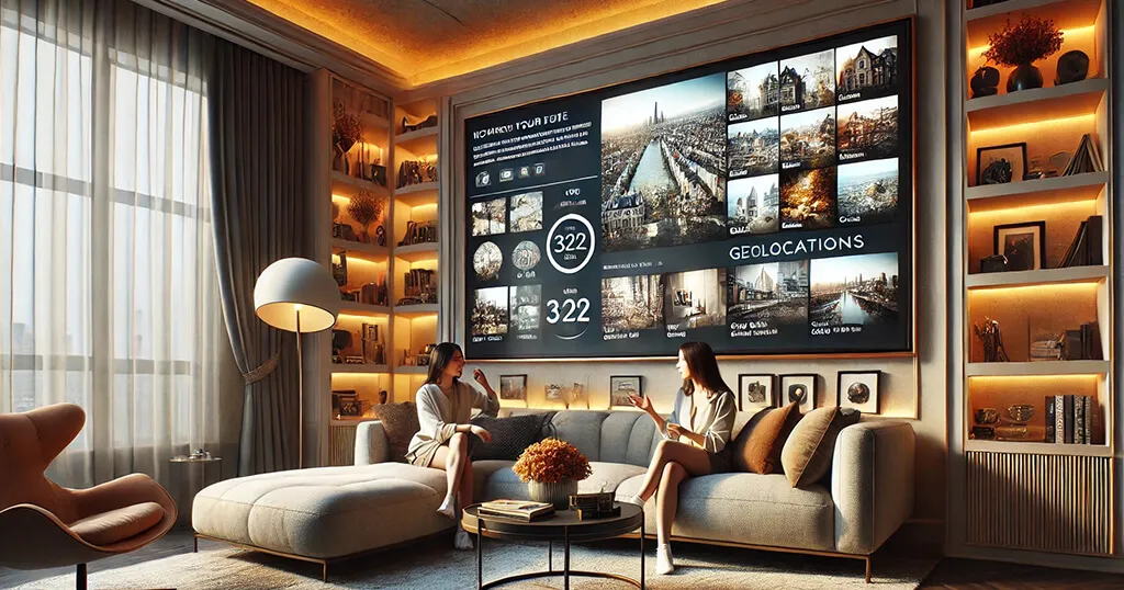
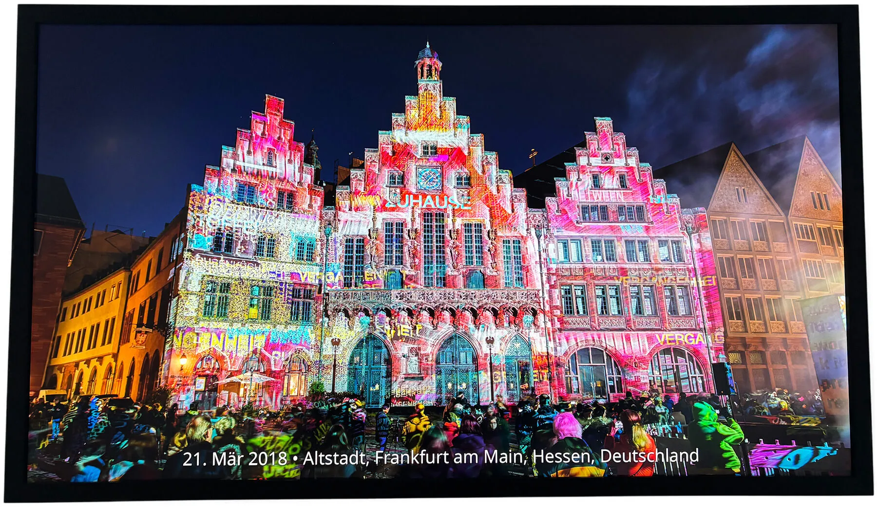
Pi3D PictureFrame includes a wonderful feature that displays the location where a photo was taken.
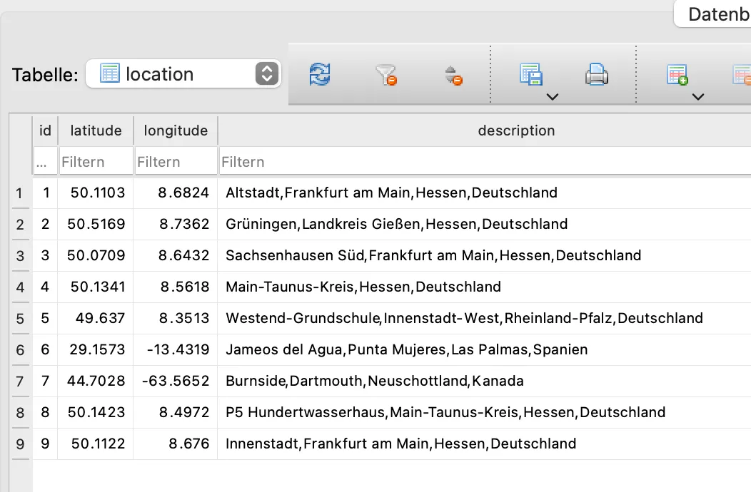
Instead of hardcoding the location information, the Exif data in the photo contains only longitude and latitude. A reverse geocoding web service translates these coordinates into names of countries, cities, streets, and more.
Geocoding services like Nominatim (used by PictureFrame), Geoapify, Geonames, or Google’s Reverse Geocoding API provide this information in various languages.
In PictureFrame’s configuration.yaml file, you can set the language for retrieving geoinformation. The location details are then gradually added to the pictureframe.db3 file, so the data doesn’t need to be retrieved again each time the photo is displayed.
By default, PictureFrame uses English, but you can change the language if needed. However, a few additional steps are required.
Installing locales
Raspberry Pi OS — Trixie today, and Bookworm before it — includes localization options for approximately 250 languages, including regional variants.
Open a terminal and type:
sudo dpkg-reconfigure locales
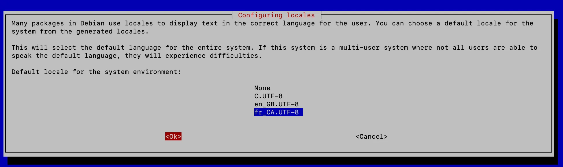
Scroll to the language you want to add. Select it by pressing the spacebar, ensuring you pick the country-specific variant (e.g., fr_CA.UTF-8 for Canadian French).
In the following dialogue, set it as your default language. The locales will then be generated.
At this point, I thought I had done everything, but the locales weren’t generated as they should be.
So here is what I did to fix it:
Edit the locale configuration file:
sudo nano /etc/default/locale
Ensure it contains the following lines for your chosen language:
LANG=fr_CA.UTF-8
LC_CTYPE="fr_CA.UTF-8"
LC_ALL="fr_CA.UTF-8"
In my case, the last two lines were missing. Add them if necessary.
Apply the local settings with:
export LANG="fr_CA.UTF-8"

export LC_CTYPE="fr_CA.UTF-8"

export LC_ALL="fr_CA.UTF-8"
Verify the settings by typing:
locale
The output should look similar to this:
LANG=fr_CA.UTF-8
LANGUAGE=
LC_CTYPE="fr_CA.UTF-8"
LC_NUMERIC="fr_CA.UTF-8"
LC_TIME="fr_CA.UTF-8"
LC_COLLATE="fr_CA.UTF-8"
LC_MONETARY="fr_CA.UTF-8"
LC_MESSAGES="fr_CA.UTF-8"
LC_PAPER="fr_CA.UTF-8"
LC_NAME="fr_CA.UTF-8"
LC_ADDRESS="fr_CA.UTF-8"
LC_TELEPHONE="fr_CA.UTF-8"
LC_MEASUREMENT="fr_CA.UTF-8"
LC_IDENTIFICATION="fr_CA.UTF-8"
LC_ALL=fr_CA.UTF-8
Changing the language in PictureFrame
Open configuration.yaml and locate the following line:
locale: "de_DE.utf8" # "locale -a" shows the installed locales which could used
Replace “de_DE.utf8” with your language code.
Save and close the file.
Deleting the database
The last step is to delete the database so that the geolocation can be retrieved freshly in your chosen language.
Navigate to the following directory
~/picframe_data/data
(that is picframe_data, with an “a” — earlier versions of this article had a typo there, and /home/pi/ only applies if your user is actually called pi, which is no longer the default on Raspberry Pi OS)
and delete the file
pictureframe.db3
This can be done while PictureFrame is running.
Reboot your system and verify that the locations are now displayed in your selected language.
On picframe3 there is nothing to do
This whole procedure is for the pi3d route. On picframe3 the language of place names is a setting, geo.language, a two-letter code you pick during the installer's place names question or afterwards on the settings page. It does not depend on a system locale being generated, so there is no dpkg-reconfigure locales dance and nothing to fix up in /etc/default/locale.
There is also no database to delete. If you change the language and want the names you already have rewritten, run:
picframe3 scan --regeocode
The language that month and day names are written in is a separate setting, viewer.locale — that one does want a generated locale on the Pi, and picframe3 doctor tells you whether it is there.
Conclusion
The ability to set the geodata language is another great detail of Pi3D Picture Frame. Now you know how you can make it even more personal.
Was this article helpful?
Thank you for your support and motivation.